Polygon Islands Convenience Method?
-
Hi!
Is there an available convenience method for getting all polygon islands in a polygon object? It seems like one exists internally for things like the
Texture > View > Multi-Color Islandsoption.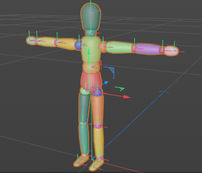
Specifically, I'm looking for polygon islands/shells, but an additional command/option for UV Islands would be great too.
If one doesn't exist, I'd like to request that one be added to the Python SDK.
Thank you,
Donovan
-
Hi @dskeith,
thank you for reaching out to us. There is unfortunately no solution out of the box with which you can achieve this. And it is also rather unlikely that we will add such a functionality. To implement it yourself, you could make use of either:
c4d.utils.SendModelingCommandwithMCOMMAND_SELECTCONNECTED. This will work with Ngons, but will come with a lot of overhead due to SMC.c4d.utils.Neighbor. You can also make this work for Ngons, but it will bee harder because you have to deal then with the translation maps. Algorithmically this will be "cleaner".
You will find below an example for the first option.
Cheers,
Ferdinandedit: For uvs things would work in a similar fashion.
"""On how to select polygon islands. As discussed in: https://developers.maxon.net/forum/topic/13194 Written for R23. """ import c4d def GetPolygonIslandSelections(node): """Yields connected polygon island id lists for a polygon mesh. Args: node (c4d.PolygonObject): Description Yields: list[int]: An island of polygon ids. """ if not isinstance(node, c4d.PolygonObject): raise TypeError(f"Expected PolygonObject for node, received: {node}") # The polygon selection of the node and some stuff. selection = node.GetPolygonS() count = node.GetPolygonCount() polygonIdSeeds = list(range(count)) def selectConnected(node, index): """Selects the connected polygons for a given polygon index. """ selection.DeselectAll() selection.Select(index) kwargs = {"command": c4d.MCOMMAND_SELECTCONNECTED, "list": [node], "mode": c4d.MODELINGCOMMANDMODE_POLYGONSELECTION, "bc": c4d.BaseContainer(), "doc": doc} return c4d.utils.SendModelingCommand(**kwargs) # We could also write "while polygonIdSeeds:", but while loops give me # anxiety ^^ for _ in range(count): # Select all polygons connected to the first polygon id in our seeds. if not selectConnected(node, polygonIdSeeds[0]): raise RuntimeError("Something went wrong.") # Evaluate the new selection state. island = [i for i, v in enumerate(selection.GetAll(count)) if v] # Yield the island. yield island # Intersect our remaining seed ids with that island. polygonIdSeeds = [pid for pid in polygonIdSeeds if pid not in island] # Break out if we exhausted all of them. if not polygonIdSeeds: break # Clean up the selection. selection.DeselectAll() def CreatePolygonSelectionTag(node, selectionIds): """Generates a polygon selection tag for the given polygon ids. """ if not isinstance(node, c4d.PolygonObject): raise TypeError(f"Expected PolygonObject for node, received: {node}") # The polygon selection. selection = node.GetPolygonS() # Clean up the selection. selection.DeselectAll() for index in selectionIds: selection.Select(index) # Create a selection tag fur the current polygon selection. kwargs = {"command": c4d.MCOMMAND_GENERATESELECTION, "list": [node], "mode": c4d.MODELINGCOMMANDMODE_POLYGONSELECTION, "bc": c4d.BaseContainer(), "doc": doc} return c4d.utils.SendModelingCommand(**kwargs) def main(): """Entry point. """ i = 0 for island in GetPolygonIslandSelections(op): if not CreatePolygonSelectionTag(op, island): raise RuntimeError("Could not create polygon selection tag.") i += 1 c4d.EventAdd() print (f"Added {i} selection tags.") if __name__ == '__main__': main() -
And another good resource is the Calculate Group per Polygon from Cesar Vonc.
Cheers,
Maxime. -
here is a script i use to color polygon groups. unfortunately a bit slow
import c4d from c4d import gui import random def main(): random.seed(666) c4d.CallCommand(12139) # point mode selection = doc.GetActiveObjects(c4d.GETACTIVEOBJECTFLAGS_NONE) for s in selection: cnt = s.GetPointCount() tag = c4d.VariableTag(c4d.Tvertexcolor, cnt) data = tag.GetDataAddressW() bs = s.GetPointS() done = [] for i in range(cnt): if i in done: continue r = random.random() g = random.random() b = random.random() c = c4d.Vector4d(r,g,b,1) bs.DeselectAll() bs.Select(i) c4d.CallCommand(12557) sel = bs.GetAll(cnt) for index, selected in enumerate(sel): if not selected: continue done.append(index) c4d.VertexColorTag.SetColor(data, None, None, index, c) done = list(set(done)) s.InsertTag(tag) # Execute main() if __name__=='__main__': main() -
Wow! What an incredible set of answers. You've each addressed a different thing I intended to do with these polygon groups once I had access to them.
Thank you @ferdinand @m_adam and @pyr!
-
Z zauhar referenced this topic on
-
this script breaks an poly object into island, colorized it by random, offset to center of bounding box and some noise. after that i connects all islands again.
its super fast compared to my older "solution"
import c4d from c4d import gui import random def AddVertexColor(s,center,rad): cnt = s.GetPointCount() tag = c4d.VariableTag(c4d.Tvertexcolor, cnt) data = tag.GetDataAddressW() bs = s.GetPointS() bs.SelectAll(cnt) done = [] points = s.GetAllPoints() r = random.random() for i in range(cnt): g = (points[0]-center).GetLength() / rad b = c4d.utils.noise.Noise(points[0]*0.01,rad) c = c4d.Vector(r,g,b) c4d.VertexColorTag.SetColor(data, None, None, i, c) s.InsertTag(tag) def main(): random.seed(666) selection = doc.GetActiveObjects(c4d.GETACTIVEOBJECTFLAGS_NONE) for s in selection: center = s.GetMp() rad = s.GetRad().GetLength() c4d.CallCommand(12298) c4d.CallCommand(17891) mesh = s.GetDown() while mesh: AddVertexColor(mesh,center,rad) mesh = mesh.GetNext() c4d.CallCommand(100004768) c4d.CallCommand(16768) # Execute main() if __name__=='__main__': main() -
Here is something I recently used to count UV Islands as well as get some other info
import c4d
from collections import defaultdict

def get_uv_islands(obj, tol=1e-5):
    """
    Compute UV islands for the given polygon object using its UVW tag.
    This version retrieves the UV dictionary for each polygon using uvTag.GetSlow(polyIndex),
    then groups connected polygons (sharing at least one UV coordinate) into islands
    using an iterative flood-fill algorithm.
    """
    uvw_tag = obj.GetTag(c4d.Tuvw)
    if uvw_tag is None:
        c4d.gui.MessageDialog("The object does not have a UVW tag.")
        return None

    poly_count = obj.GetPolygonCount()

    # Build maps:
    # - face_to_uvs: mapping from polygon index to its set of rounded UV keys.
    # - uv_to_faces: reverse mapping from each UV key to the set of polygon indices using that UV.
    face_to_uvs = defaultdict(set)
    uv_to_faces = defaultdict(set)

    def uv_key(vec):
        # Round UV vector components to mitigate floating-point precision issues.
        return (round(vec.x, 5), round(vec.y, 5))

    # Build connectivity maps based on each polygon's UV data.
    for poly_index in range(poly_count):
        poly = obj.GetPolygon(poly_index)
        uv_data = obj.GetTag(c4d.Tuvw).GetSlow(poly_index)
        # If the polygon is a triangle, remove the extraneous 'd' key.
        if poly.IsTriangle() and 'd' in uv_data:
            del uv_data['d']
        for key in uv_data:
            uv_vec = uv_data[key]
            key_tuple = uv_key(uv_vec)
            face_to_uvs[poly_index].add(key_tuple)
            uv_to_faces[key_tuple].add(poly_index)

    # Use an iterative flood-fill to group connected faces.
    islands = []
    faces_left = set(range(poly_count))

    while faces_left:
        island = []
        start_face = next(iter(faces_left))  # Pick an arbitrary face from unvisited ones.
        stack = [start_face]
        while stack:
            face_idx = stack.pop()
            if face_idx not in faces_left:
                continue
            faces_left.remove(face_idx)
            island.append(face_idx)
            # For every UV key in this face, add all neighboring faces.
            for uv_val in face_to_uvs[face_idx]:
                for neighbor in uv_to_faces[uv_val]:
                    if neighbor in faces_left:
                        stack.append(neighbor)
        islands.append(island)

    return islands

def get_island_uv_center(obj, uvw_tag, island):
    """
    Given a polygon object, its UVW tag, and an island (list of polygon indices),
    compute the UV bounding box and center.
    """
    # Initialize min/max with infinities.
    min_u = float('inf')
    max_u = -float('inf')
    min_v = float('inf')
    max_v = -float('inf')
    # Gather unique UV coordinates from all faces in the island.
    unique_uvs = {}
    for face_idx in island:
        poly = obj.GetPolygon(face_idx)
        uv_data = uvw_tag.GetSlow(face_idx)
        if poly.IsTriangle() and 'd' in uv_data:
            del uv_data['d']
        for key in uv_data:
            uv = uv_data[key]
            key_tuple = (round(uv.x, 6), round(uv.y, 6))
            unique_uvs[key_tuple] = uv

    # Compute the bounding box.
    for uv in unique_uvs.values():
        if uv.x < min_u:
            min_u = uv.x
        if uv.x > max_u:
            max_u = uv.x
        if uv.y < min_v:
            min_v = uv.y
        if uv.y > max_v:
            max_v = uv.y

    center_u = (min_u + max_u) / 2.0
    # Invert V axis so the center is correct in UV space.
    center_v = 1.0 - ((min_v + max_v) / 2.0)

    return center_u, center_v, min_u, max_u, min_v, max_v

def main():
    doc = c4d.documents.GetActiveDocument()
    obj = doc.GetActiveObject()
    if obj is None:
        c4d.gui.MessageDialog("Please select a polygon object.")
        return

    uvw_tag = obj.GetTag(c4d.Tuvw)
    if uvw_tag is None:
        c4d.gui.MessageDialog("The object does not have a UVW tag!")
        return

    islands = get_uv_islands(obj)
    if islands is None:
        return

    num_islands = len(islands)
    print("Number of UV islands:", num_islands)
    for idx, island in enumerate(islands):
        center_u, center_v, min_u, max_u, min_v, max_v = get_island_uv_center(obj, uvw_tag, island)
        print("Island", idx, "has faces:", island)
        print("Island Num",idx,"    Bounding Box: U [{:.6f}, {:.6f}], V [{:.6f}, {:.6f}]".format(min_u, max_u, min_v, max_v))
        print("                 Center: U = {:.6f}, V = {:.6f}".format(center_u, center_v))

if __name__=='__main__':
    main()
Output looks something like
Number of UV islands: 2
Island 0 has faces: [0, 5, 3, 4]
Island Num 0     Bounding Box: U [0.004902, 0.495098], V [0.004902, 0.740196]
                Center: U = 0.250000, V = 0.627451
Island 1 has faces: [1, 2]
Island Num 1     Bounding Box: U [0.004902, 0.495098], V [0.750000, 0.995098]
                Center: U = 0.250000, V = 0.127451
Hope it is useful!